Walk and Cycle
There are lots of walks and rides available from the line. The main long distance routes are:
The England coastal path in our area so far extends for 22 miles (35km) from Allonby, north of Maryport to Whitehaven. Work is progressing on the next stage south to Silecroft. http://www.nationaltrail.co.uk/england-coast-path/about
Wainwright’s Coast to coast walk from St Bees to Robin Hood’s Bay http://www.visitcumbria.com/coast-to-coast-walk
C2C (sea to sea) cycle route from Workington and Whitehaven to Newcastle and Sunderland http://www.sustrans.org.uk/ncn/map/route/sea-to-sea-c2c
 Hadrian’s Cycleway from here at Ravenglass to South Shields
Often you can walk from one station to the next eg each station from Maryport to Whitehaven, Sellafield to Seascale or Seascale to Drigg – some examples are below.
Here are nine walks we have developed for a printed walks leaflet from the Cumbrian coast line. (The link to the leaflet may take a few seconds to load and one page will be upside down. It includes pictures of the routes.) At the bottom of this page are longer version of two of the walks – Whitehaven to Harrington and St Bees.
Walk 1 Dalston circular walk
3 miles (5km)
1¼ hours
Station: Dalston
Terrain: pavements and riverside grass and earth path which can be muddy and uneven but with pavement alternative
Refreshments: pub, café and takeaways in The Square
Toilets: The Square
Coming from Carlisle just exit the station, otherwise cross the bridge first. Follow the pedestrian markings and turn left onto Station Road. In 250 yards turn right at the T junction onto Carlisle Road (B5299). St Michael’s church is on your left. Walk through The Square and along The Green past the Co-op on your right to the Victory Hall. Take the gate across the road onto the village green. Bear left through the field and before the white bridge turn right on the path by the river Calder, leading to a narrow woodland path. After a kissing gate the path splits – take the upper fork which leads you back to the road on your right before the bridge at Bridge End. (If you take the path nearer the river there is a short steep path just before the bridge. If the riverside walk is likely to be wet you can follow the road instead to Bridge End.) Turn left and cross the river bridge. Go ahead and over another bridge over the stream. Then turn left at the Cowen’s Mill sign and along the lane through the middle of Cowen’s factory. Follow the path and cross the stream at the sandstone bridge followed by the white bridge you saw earlier. Continue past the Millennium Crow sculpture just before The Square. Then return to the station.
If you need a flat route: exit from the station on the northbound platform by turning left off the train to the end of the platform, follow the path to the road and turn left through the industrial estate. At the T junction by the artificial cows turn left onto Barras Lane, over the bridge bear left to reach Station Road. This will add at least ten minutes and much of it is on a busy road without a pavement. It might be better to stay on the train to Carlisle and come back to Dalston. In the village you can avoid the narrow grassy path by continuing along the road to Bridge End.
Walk 2 Maryport circular walk
3 miles (5km)
2 hours
Station: Maryport
Terrain: roads and paths with short section of grass and optional steps
Refreshments: Senhouse Street and harbour area
Toilets: High Street and harbour
Cross the road from the station onto Station Street. At the main road turn right on Curzon Street and first left along Senhouse Street. (To avoid steps turn right at the top of the hill onto High Street and at Fleming Square left to rejoin the route above the harbour.) After High Street are interpretation panels on the left about the Maryport and Carlisle Railway and the town. On the left before the bridge is the Maritime Museum with links to the Ismay Line and the Titanic. (Cross the bridge from here to divert to the harbour area with the aquarium (tourist information), Wave Centre and climbing wall and marina.) Opposite the museum follow King Street. At Wallace Lane on your left turn right on Brow Street. Ahead are the 108 Back Brow steps. (Stop and admire the view on the way! There are also plenty of seats on the walk.) At the top turn left on a grass path and then right to see the Georgian buildings of Fleming Square. Return to the sea brows keeping the sea on your left along Solway Terrace to Senhouse Roman Museum with the best collection on Roman altars in Britain. This is the continuation of Hadrian’s Wall and part of the UNESCO Roman Empire World Heritage Site with explanatory panels. There is a signpost labelled Rome 1147, Ravenglass 29, Bowness on Solway 26, Wallsend 110. Continue on the path to the left of the museum and after a while there is a fork. Left goes directly down to the promenade and right gives an extra ½ mile walk, again joining the promenade where optionally you can turn right to Bank End Farm and along the England Coast Path to Allonby up the coast. Otherwise turn left on the promenade and admire the views across to Criffel in Scotland as you walk back towards the town. When the promenade is almost level with the harbour wall bear left (there is a coast path sign) onto Strand Street and the Maritime Museum ahead. Now return to the station.
Walk 3 England coast path Allonby-Whitehaven
Allonby-Maryport 5 miles (8km), Maryport-Flimby 2 miles (3km), Flimby-Workington 4 miles (7km), Workington-Harrington 4 miles (7km), Harrington-Parton 3 miles (5km), Parton-Whitehaven 2 miles (3km) total 20 miles (33km)
Best done in sections over more than one day
Stations: Maryport, Flimby, Workington, Harrington, Parton, Whitehaven (Flimby and Parton are request stops)
Terrain: mostly good paths but some steep sections between Harrington and Parton (this section is not suitable for wheelchairs or pushchairs)
Refreshments: each of the towns and villages
Toilets: Allonby village, Maryport High Street and harbour, Workington Central Way (town centre), Whitehaven station
For the section from Allonby to Maryport catch the 60E bus from Maryport (four a day Monday to Friday, five on Saturday) and walk back.
From Maryport to Flimby come out of the station, cross the road onto Station Street and at the main road (where you will see the bus stops) turn right on Curzon Street and first left along Senhouse Street down to the harbour. Then follow the signs for the England Coast Path until you get to Flimby station. You will be following the coast all the way.
From Flimby to Workington again just follow the England Coast Path or for a slightly more inland route signs for Hadrian’s Cycle Way. With the latter you will need to turn right in the town centre back to the station as described on the Whitehaven-Harrington-Workington walk.
From Workington you can continue following the coast path signs by turning left from outside the station around the coast through Harrington and Parton to Whitehaven or take the shorter and less steep cycle path described in the next walk.
Obviously these can all be short walks from one station to the next.
The path will shortly continue north from Allonby through Silloth to Carlisle and Gretna and south from Whitehaven around the harbour and over the cliffs to St Bees and along the coast.
Walk or cycle 4 Whitehaven-Harrington cycle path
Whitehaven-Parton 2 miles (3km), Parton-Harrington 4 miles (7km)
½ hour to Parton and a further 1½ hours to Harrington
Stations: Whitehaven, Parton, Harrington, (Workington, Flimby, Maryport) – Parton and Flimby are request stops
Terrain: foot and cycle paths with a small amount on roads, possibility of beach walk at Parton with one steep section going into Lowca
Refreshments: Whitehaven, Parton and Harrington pubs and shops
Toilets: Whitehaven station, Workington Central Way (town centre)
Come out of Whitehaven station. Turn sharp left after the filling station onto Bransty Road and immediately left again to National Cycle Route 72 and Hadrian’s Cycleway. You pass the remains of William Pit. Look back over Whitehaven at the chimney of Wellington Pit across the harbour and St Bees Head. At sea on a clear day you will see the Isle of Man and the Scottish coast. Arriving in Parton the path becomes Bank Yard Road. Turn left onto Main Street through the village. Parton station is on the left.
Main Street becomes Foundry Road. At the T-junction either turn left to continue towards Harrington or right for 200 yards to St Bridget’s Church and Moresby Roman Fort. Opposite the church is Moresby Hall, largely designed by Inigo Jones in the seventeenth century. Retrace your steps and climb the hill into Lowca, taking the first right into the uneven Stamford Hill. Bear right at the end and follow the cycleway signs onto the former Whitehaven, Cleator and Egremont Railway which closed in 1973. Passing Distington village, opposite the flat-topped houses of Barfs Road is a sculpture of a woman and child. The path turns left under the bypass. Turn left at the junction towards Harrington now joining the Cleator and Workington Junction Railway. You come to High Harrington, mainly passing bungalows. There is a bridge with a separate footbridge after it supported by a strange corrugated iron structure.
To walk further, continue to Workington’s Central Station car park. Turn left along Oxford Street past the oldest purpose built bus station in Britain (1926) and carry straight on to Workington station (3 miles, 5km). Alternatively continue straight on from the car park to follow the path to Flimby or Maryport stations.
For Harrington station, turn sharp left off the cycle path. Turn right onto Main Road and down the hill. Turn left at the traffic lights down Church Road. At the end turn sharp right to the station with its Harrington humps, raised sections on the very low platform which are replicated at other stations on the line and elsewhere.
There is a more detailed version of this walk at the bottom of the page
Walk 5 St Bees circular walk
3 miles (5km)
1½ hours
Station: St Bees
Terrain: roads and grass path with alternative of beach
Refreshments: pubs in village and beach café
Toilets at beach
From the station with its Arts and Crafts signal box go uphill on Main Street. Cross the road onto Finkle Street at the Albert Hotel then turn right onto Cross Hill. On the left is the house of Edmund Grindal, 16th century Archbishop of Canterbury and founder of St Bees School. Continue up Main Street past the pubs and Post Office. On the left is the West Cumberland Railway Museum. After the Outrigg junction is the Methodist church on the right. Near the top of Main Street at a notice board turn right onto Sea Mill Lane. There is a right bend under the railway line. To the left are 1920s beach bungalows. In front is the Sea Mill foreshore sign. Turn right through the car park. Follow the cliff path across the beck, ignoring the footpath sign on the right and take the path between the beck and the golf course. This will be part of the England Coast Path. Ahead is St Bees Head, the start of the coast to coast walk and the nearest point in England to the Isle of Man and Northern Ireland. There is usually a view of the Isle of Man and Scotland. Keep to the cliff top over stiles and leave the path between the Seacote Hotel and the beach shop. In front are the beach, playground, toilets and lifeboat station. Turn right in front of the hotel to follow Beach Road. Near the golf club entrance is the junction of Abbey Road to the left and Station Road to the right. Opposite is a footpath which leads to the Priory – if it is too muddy use Station Road instead. Following the path on the left you come to the Priory Paddock Wildflower Garden. At the end of the garden to your left is a gate into the churchyard. Then move to the front of the Priory with its beautiful Norman west door. Coming out of the priory grounds you are facing the St Bees School (closed until September 2018). Turn right back onto Main Street to your starting point.
There is a more detailed version of this walk at the bottom of the page
Walk 6 Drigg to Seascale (and Sellafield)
3 miles (5km)
1½ hours
Stations: Drigg (a request stop), Seascale, Sellafield
Terrain: quiet road, grassy and sandy path and beach (not suitable for wheelchairs and pushchairs from Drigg beach to Seascale)
Refreshments: pub and tea room at Drigg station, café, pub and shops in Seascale
Toilets in Seascale village car park
This is a walk of three fairly equal parts – road, dunes and beach. From Drigg station from southbound trains cross the level crossing then follow the road by the signal box. The dark shape of Black Combe is on the left but soon will be behind and the Low Level Waste Repository is to the right. Before you reach the beach (which is worth visiting) there are some interpretation panels. Turn right through the gate by the black corrugated iron building onto Drigg Dunes nature reserve. Among the marron grass are many rare plants, birds and natterjack toads. There is a fairly clear path all the way with some wooden stakes in places to guide you and good views over the Irish Sea. Most days you can see the Isle of Man, the north end of which is opposite Seascale. When you reach a small road coming down to the sea it is better to walk on the beach, as paths through the dunes are indistinct and peter out at a stream. Exceptional spring tides may mean you cannot walk along the beach – if in doubt try starting from Seascale, but this is usually fine even at high tide. You will see Sellafield ahead of you and then Seascale comes into view. There is a short promenade before the jetty, where you turn inland at the village car park to Seascale station. For southbound trains go through the archway ahead and left to the platform.
If you want to continue from the jetty take the path between the car park and the sea as far as Sellafield station, a further 2 miles (4km). After a mile you get to the point where the rivers Ehen and Calder reach the sea and the path turns inland and over a white painted bridge before following a minor road next to the Sellafield site and to the station. This path should be passable for wheelchairs, though a little narrow at one point.
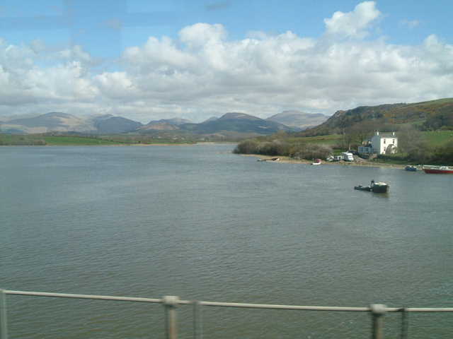
Walk 7 Ravenglass circular walk
2½ miles (4km)
1¼ hours
Station: Ravenglass for Eskdale
Terrain: paths and beach
Refreshments: Ratty Arms on the station, Ravenglass and Eskdale railway café and in the village
Toilets in village car park and steam railway
Ravenglass, Bootle and Silecroft are the three stations in the Lake District National Park. Going northbound exit at the back of the Ravenglass platform and take the path over the bridge (wheelchairs and pushchairs will need to go out of the other exit next to the Ratty Arms and through the car park). Southbound go into the Ravenglass and Eskdale Railway (Ratty) and take the path next to the turntable with the playground on your left. Follow the path until it reaches a road. Turn right on the signposted Esk Trail and near the caravan site take the footpath to the left of the road. Continue to Walls Castle, the Roman bath house with its interpretation panels. There would have been more to see here if the Victorians hadn’t built the railway line across the site. Retrace your steps part of the way to the dip by the small footbridge and turn left under the railway bridge (mind your head!). This brings you out onto the beach by the River Esk. At the bottom of Main Street are panels explaining that Ravenglass was a second century Roman port, the southern extremity of the fortifications that form Hadrian’s Wall and that by the 17th century it was the busiest port in Cumberland. Walk up Main Street enjoying the old buildings including a vintage petrol pump. At the top turn left to walk over the viaduct beside the railway line and view the village from the other side of the River Esk before returning to the station.
Don’t forget to explore the Ratty and its museum. From here the line goes to Dalegarth, about three miles from Hardknott Roman Fort. There are booklets of Walks from the Ratty in the railway shop.
You can also walk up the path beside the main road for a mile to Muncaster Castle with its gardens and displays of birds of prey and back along a path from beside the payment booth.
Walk 8 Millom and Hodbarrow nature reserve circular walk
8 miles (13km)
3 hours
Station: Millom
Terrain: solid roads and paths with large puddles in places, beach and a little grass – boots are recommended
Refreshments: Trackside café at the station and other places in Millom
Toilets at station and in park
From the southbound platform turn left from the station and over the bridge. Northbound either go up the steps near the front of the train or from the back of the platform turn right past the supermarket. Go through Market Square. Turn left at the end onto St George’s Terrace. At no 14 is a coffee shop with a plaque above to Norman Nicholson, the poet who is Millom’s most famous son and lived here all his life. Back at the square continue past St George’s church where you can find Norman’s grave and the north window which is dedicated to him. Continue along St George’s Road past the park up to the infant school on your left and then straight on along Devonshire Road. Pass the Devonshire Hotel and opposite the industrial estate follow the brown Millom Ironworks LNR (local nature reserve) sign on the left. There is a small stile and an interpretation board at the entrance. This is one of the main sites for the rare natterjack toads. Go left and follow the path to a wider path to the right along the Duddon estuary. All the way along are good views across into Furness with Barrow on the right. Looking back from the beach is the long shape of Black Combe. After a while go through the gate labelled Port Millom and continue until the path reaches the beach. Turn right and after it becomes stonier there is a line of wooden posts with trees to the right. Go through the gate on your right and immediately through another on the left. Follow the path to a public footpath sign and turn right. The grassy path becomes a paved road leading to Hodbarrow Lake nature reserve with interpretation panels. You could carry on to Haverigg but turn right on the footpath beside the road. At a public byway sign turn right onto Mainsgate Road which leads back to the infant school and left to the station.
For a walk with wheelchairs or pushchairs just go out along Maingate Road and explore Hodbarrow.
Walk 9 Foxfield Duddon mosses circular walk
4 miles (6km)
2 hours
Station: Foxfield
Terrain: short section of road then paths with boardwalks and farm roads which can be boggy in places. Only suitable for wheelchairs and pushchairs by following alternative quiet roads in places.
Refreshments: Prince of Wales pub opposite station (Friday-Sunday lunchtimes and all evenings)
Turn right from the station onto the A595 and follow it for ¼ mile to the second turning on the right. Follow the lane to a bridge, cross it then follow the track to a fork. Take the left branch and follow the track past the two cottages to the entrance to Duddon Mosses Nature Reserve. A tree-lined track on the left leads beside Otter Pool stream and around the edge of the moss. Follow it, taking time to explore sections of the two boardwalks that branch off left and right, until you reach a footpath junction at Bank End Moss. (For a shorter walk turn back here.) Turn right and head along the path for ¼ mile to a footbridge. Cross it and then continue along the narrow and often damp path as it turns right then left to reach the road beside the farm at Waitham Hill. Turn right on to the farm road and follow it over Angerton Moss bearing left to the level crossing. Carefully cross the line and then turn right at the next junction. The road leads along the foreshore to the level crossing you passed at the start of the walk. Turn left and follow the main road back to the station.
Longer versions of two of the walks above:
Whitehaven – Parton – Harrington (or to Workington and beyond)
This walk starts from Whitehaven station and goes to Harrington. Alternatives are Whitehaven to Parton, Parton to Harrington and an extension to Workington and beyond. As it almost all follows a national cycle route it is equally good by cycle (which can be carried on the trains). Whitehaven to Parton is about 1½ miles and Parton to Harrington a further 4 miles. Most of it follows two disused railway lines.
In this direction there is a short, steep hill from Parton to Lowca. If you do it in the opposite direction towards Whitehaven there is a steep section on the main road in Harrington.
All trains on the Cumbria coastal line stop at Whitehaven, Harrington and Workington. Parton is a request stop – ask the conductor or give a hand signal to the driver. Trains between Carlisle and Barrow run roughly hourly with some trains extended to Lancaster and Preston.
Come out of Whitehaven station on Station Road. Tesco on your right has a café. Just to the right at the end of the road is the Bransty Arch, a Wetherspoons pub that serves food. There are lots of other places to eat and drink in the town which is to your right and well worth exploring. It was the first planned Georgian town in England and has some fine buildings. The harbour area now has a marina. The main tourist attractions are the Beacon museum and gallery on the far side of the harbour and the Rum Story in the main Lowther Street which leads from the harbour to Castle Park, recalling Whitehaven’s part in the triangular trade with West Africa and Virginia which brought rum and tobacco to the warehouses of the town. The other Whitehaven station is at Corkickle, through the tunnel under the town built because the then Lord Lonsdale would not allow a line through the streets.
At the end of Station Road is the main road (A5094 Bransty Row). Turn sharp left after the Tesco garage onto Bransty Road and immediately left again. You should see the sign for National Cycle Route 72 or Hadrian’s Cycleway which we follow to Harrington. The cycleway stretches from the Roman fort at Ravenglass to Bowness on Solway, the start of Hadrian’s Wall, and on through Carlisle to the northeast. At this point you are also on the Cumbria Coastal Way. This follows the same route through Parton but carries on up the road through Lowca along a dangerous stretch without a pavement before turning onto paths to Harrington.
The station is to the left of the road. You soon start passing through the remains of William Pit. If you look back over Whitehaven you will see the chimney of Wellington Pit on the far side of the harbour, the site of one of the worst mining tragedies in Britain in 1910 when 136 miners died, and Whitehaven lighthouse. Beyond is St Bees Head. Out to sea on a clear day you will see the Isle of Man with Snaefell on top and further round to the north the Scottish coast, only 20 miles away with Robin Rigg offshore wind farm in the Solway Firth.
Just before the first white house on the right at Parton is a millennium milepost telling you it is 1½ miles to Whitehaven and 6 miles to Workington.
Shortly afterwards on the left is the first of several archways under the railway leading to the beach (mind your head though!). If you wish you can look at pebbles and shells before returning to the path a little further up the coast. Keeping to the path, you pass the remains of the brickworks on the right.
The path becomes Bank Yard Road. Turn left onto Main Street through the village. Parton station is on the left, in The Square next to the war memorial. Also on Main Street near the station is a convenience store, bakers, pub and children’s playground.
To get to Harrington continue along Main Street which becomes Foundry Road. At the new sewage works on the left the pavement ends for a short distance on this quiet road, following Lowca Beck.
At the T-junction there are two choices. Turn left to continue towards Harrington or right for two hundred yards to St Bridget’s Parish Church at Moresby, an interesting Georgian building with medieval remains on the site of Moresby Roman Fort. There is an interpretation panel at the end of the churchyard explaining the layout of the fort. The views from here show the strategic importance of the site. Opposite the church is Moresby Hall, largely designed by Inigo Jones in the seventeenth century though with older parts.
Retrace your steps and climb the steep hill into Lowca, taking the first turning on the right into Stamford Hill that is an uneven road. Bear right at the end keeping the iron gates on your right and follow the cycleway sign. Pass the glasshouses of a flower nursery on the right. The view to the right is over Howgate to Low Moresby with the fells near Loweswater beyond. If you look back the view is of Moresby Church with St Bees Head behind.
You are now on part of what was once the Whitehaven, Cleator and Egremont Railway between Parton and Distington, the last part of which closed in 1973. There are seats along the cycleway, though the stone ones can be wet. Pass kennels on either side of the path, usually with greyhounds in them. The path veers right and under the bypass by a beck where there is a picnic table. Up the slope from here you will often find horses on the path or in the fields as well as sheep.
The next settlement you see on the right is Common End, the first part of Distington. The first access to Distington itself is just after the floodlights of the rugby league ground on the right. This leads to the Church of the Holy Spirit and down to the village which has shops including a Co-op and fish and chip shop.
Opposite the flat-topped houses of Barfs Road is a sculpture of a woman and child. More glasshouses can be seen over the grass to the right.
You now reach a junction. To the right is the access road through Ennerdale Terrace and Barfs Road to Distington Toll Bar. The path turns left through the tunnel under the bypass. Again there is a junction. The path to the right leads to Lillyhall industrial estate and Lakes College West Cumbria. Turn left towards Harrington. At this point you join another former railway, the Cleator and Workington Junction Railway line which passes through the former Central station in Workington (as opposed to Workington Main where the current station is).
The path passes under Charity Lane near the golf driving range. You come to High Harrington, mainly passing bungalows. There is a bridge with a separate footbridge after it and supported by a strange corrugated iron structure. If you are going to Harrington turn left here.
If you want to walk further, continue on the path for another 2½ miles to Workington. It takes you into the old Central Station car park. Turn left along Oxford Street past the library and the oldest purpose built bus station in Britain (1926) and carry on for ¼ mile to Workington station. Alternatively continue straight on to follow the path as far as Flimby or Maryport stations.
If you are going to Harrington station, turn left off the cycle path. There are good views over Workington with Salterbeck in the foreground and Moorclose industrial estate to the right. Up the coast is the Siddick wind farm, just north of Workington. Turn right onto Main Road (A597) and down the hill past the Brewery House pub which serves meals and St Mary’s Church which has interesting stained glass to Beckstone Bridge. Turn left at the traffic lights down Church Road (there is a station sign), passing a sandwich shop and other shops and pubs. At the end of the road either follow the road round to the harbour or turn sharp right up Grecian Terrace to the station. The harbour has plans for another marina but also good views over the sea to the Isle of Man and Scotland and along the coast to wind farms at Lowca, Siddick and in the Solway Firth. There is a children’s playground here.
The station is notable for the Harrington humps, raised sections on the very low platform which proved successful and were replicated at other stations on the line and elsewhere. If you have a bike it will help you getting on the train.
St Bees walk
This walk starts at St Bees station but since it is circular you can also start from any point or walk in the opposite direction.
For transport use the Cumbrian coast train to St Bees from Carlisle and Whitehaven to the north and Lancaster and Barrow to the south (not Sundays until May 2018).
The beach section has stiles on the cliff top and is not suitable for wheelchairs or buggies. Public toilets are at the beach car park. There are plenty of seats along the walk. Refreshments are available at pubs, restaurants and cafes on Main Street and the beach café. Accommodation is in hotels and bed and breakfasts – this is one end of the Coast to Coast walk. The village shop and post office is also on Main Street. There is a phone box at the station. There are maps at the station, outside the post office and at the beach. A good source of information is the St Bees website www.stbees.org.uk.
From the station the walk goes up the hill on Main Street. Towards the top of the hill turn right on Sea Mill Lane. At the end turn right either on the cliff path or beach to the promenade. Turn right again on Beach Road. At junction ahead follow footpath to Priory. Turn right again to station. Without stops the walk will take under an hour and is around 3km (2 miles).
From the station with its Grade II listed Arts and Crafts signal box turn uphill along Main Street. You will often see horses here or in the paddock near the Priory. On the right is a small garden with links to Mill Hill School which was evacuated here from London in the Second World War.
Cross the road onto Finkle Street at the Albert Hotel (take care – there is no pavement on this section). On the left is the village hall (called Hodgett’s, the former Liberal Club).
Turn right onto Cross Hill. On the left is the house which was the home of Edmund Grindal who became Archbishop of Canterbury in the 16th century and founded St Bees School.
On the right is the rimming stone from the smithy which was opposite.
Rejoin Main Street up the hill past the pubs and Post Office.
On the left at no 24 is the West Cumberland Railway Museum, generally open 1000-1600 for a week a month (details on the West Cumberland Railway Museum Facebook page). Contact Peter Rooke [email protected] for more details.
Behind Main Street on the left is the village primary school.
After the Outrigg junction is St Bees Methodist Church on the right, usually open every day – a plain, simple building renovated in 2000 with its shell cross. A place to be quiet, maybe think and pray. Look over the golf course to the Isle of Man.
Turn right and walk up Main Street. At the notice board turn right onto Sea Mill Lane (beware there is no pavement and it is narrow, though with little traffic). This is the southern edge of the village.
Half way down Sea Mill Lane on the left is a house called Snaefell, with views over to the highest mountain on the Isle of Man. Just after you may see the legend I am the way the truth and the life – Jesus laid out in white stones at the right hand side of the road.
Towards the bottom is a smiling Buddha at the roadside.
There is a right bend under the railway line by a public footpath sign labelled The shore. On the left are beach bungalows – from here down through Nethertown to Braystones, best seen from the train, are lines of these bungalows which started off in the 1920s as holiday homes for West Cumbrians. In front is the Seamill Foreshore sign which gives the history of the former mill, the railway dating back to 1849, beach and cliffs.
Turn right through the small car park.
Now there is a choice of walk, either along the beach (except at high tide) with the chance to examine the stones, pools and seaweed or over the cliffs which have better views.
To follow the cliff path cross the beck, ignoring the public footpath sign on the right and take the path between the beck and the golf course.
This is part of the former Cumbria Coastal Way which stretches around the coast from Lancashire to Scotland. It will shortly form part of the England Coast Path which will eventually cover the whole coast of England.
You will see wild flowers and butterflies.
The cliffs are subject to erosion and the path here and on St Bees Head has been moved back inland several times.
After a few minutes you reach the highest point of the cliffs and may want to sit and look around.
To the left along the coast is the long dark shape of Black Combe and you may be able to see the wind farm off Walney near Barrow in Furness.
St Bees Head is the nearest point in England to both the Isle of Man, Whithorn in Scotland and Northern Ireland. Most days will give a view of the Isle of Man to the left and the Scottish coast ahead. To the right is St Bees Head, the start of the coast to coast walk to Robin Hood’s Bay .
Turn round to the land and there are glimpses of the Cumbrian fells, but the best views are from the edges of the village. However this is the best place to get the layout of the village, with the oldest parts clustered around the Priory and the newer estates on the outskirts. The exertion of climbing the cliffs is worth it.
Keep to the cliff top over stiles and leave the path between the Seacote Hotel and the beach shop where you can get snacks, drinks and excellent ice cream. In front are the beach, playground, toilet, main car park and lifeboat station. Beyond the promenade is the path leading onto the Head.
Turn right in front of the hotel to follow Beach Road. The golf club is on your right. Near its entrance is the junction of Abbey Road to the left and Station Road to the right. Opposite is a footpath, the dandy path, which leads to the Priory. (This is the only part of the walk which can get very wet – if it is too muddy use Station Road instead to reach the Priory.)
Follow the path beside the meadow and on the left you will come to the Priory Paddock Wildflower Garden www.stbees.org.uk/miscellaneous/paddock.html. Follow the boardwalk past a lily pond and pool. There is a plaque on the wall with a further reminder of Mill Hill School.
At the end of the garden to your left is a gate into the churchyard. Now move round to the front of the Priory with its beautiful Norman west door. There is lots of information about the Priory inside and it is well worth a visit. You can also buy several booklets about the church and village here as well as at the village shop.
Leaving the door on your left and the vicarage on the right brings you to the Sleeping Child Garden dedicated to those who have died young. It includes sculptures by Josephina de Vasconcellos (there is another in the priory).
At the far end of the garden you will be facing the Priory. To the right, in the area behind the altar, is Old College Hall and at right angles New College Hall, part of the theological college which flourished here in the 19th century.
Coming out of the priory grounds you are facing St Bees School, the public school which dates back to the 15th century (expected to reopen in September 2018).
Turn right back onto Main Street. At the corner of Station Road is the war memorial. Just on the right down Station Road is Beck Edge Garden which has a statue by Colin Telfer of St Bega, after whom the village is named, and details of the legend. She is reputed to have come from Ireland around 850.
You are back at your starting point.
